


All about Schull....
Goleen and the Mizen
The Mizen Peninsula, at Ireland's most south-westerly point, is
renowned worldwide for the beauty of its rugged landscape and
ancient heritage. A tour of the Mizen Ring gives you the chance to
immerse yourself in the various strands that make the Mizen unique,
from geology, flora, birds and fauna to the influence of man and his
history on the landscape.
Traveling west from Schull you drive along the bog road built
originally in the eighteenth century to carry butter to Cork for export
to the new colonies.
Round and about
Goleen
Traveling on through the townlands of Kealfadda, Ballyrisode and
Ballydevlin you arrive in Goleen. This village was built during the
nineteenth century at a crossroads where a cattle fair was regularly
held. You will notice the extremely wide road winding through the
village and all the houses were originally built as shops. Falling away
left of the village is the hidden harbour from which the village takes its
name, 'Goilin' (little inlet) is easily recognisable once you venture
down the lane. Although the harbour dries at low tide, giving great
feeding for a variety of wildlife including fox and a pheasant, there is a
deepwater quay at the entrance to accommodate fishing boats and
yachts.
Crookhaven
Crookhaven Harbour is as picturesque today as it was useful in its
heyday, being a large and sheltered harbour. You pass the old
Roadstone Quarry on the side of the mountain, which provided
metalling for the roads of Wales until 1945. There are numerous
Bronze Age field monuments scattering the hills surrounding
Crookhaven. The Ordnance Survey Discovery Series May 88 will
indicate the whereabouts for you. The village of Crookhaven has a
distinguished history as the last port of call for ships journeying to and
from America. Over the centuries ships stocked up with provisions
here before tackling the Atlantic Ocean. All the shipping lines had
agents located here to tell the ships in which port their cargo has been
sold. At the beginning of the 20th century it was said that you could
cross the harbour on the decks of boats. 700 people lived and worked
in the village against the 29 permanent inhabitants who reside here
today. Marconi came here to try to send his first radio message across
the Atlantic and he fitted the first telegraphic equipment to the Fastnet
Rock Lighthouse to communicate with the passing ships.
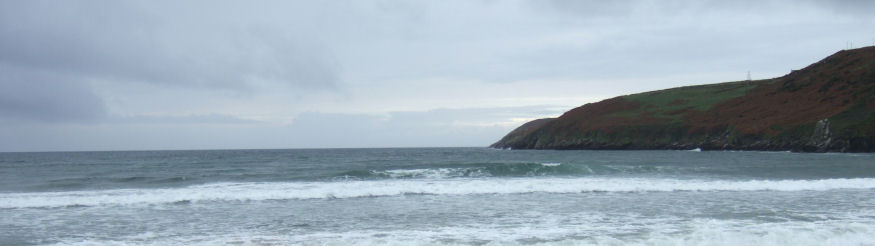
Barleycove
Barleycove is a large beach backed by sand dunes, the sand dunes
were thrown up in the tidal wave which swept Europe after the
earthquake in Lisbon in 1755. Today the dunes have been partially
eroded but are protected like much of the coastal area here as
European designated Special Areas of Conservation. The road goes to
the east of the beach across a causeway bisecting Lissagriffin Lakes
and at the T-junction you turn left to Mizen Head.
Mizen Head
Mizen Head Visitor Centre has been developed by a local tourism co-
operative. The signal station was built in 1905 to protect shipping
from the cliffs during fogbound journeys. It is a spectacular location
with its folded rocks and high cliffs. The signal station is on an island
joined to the mainland with a fine example of an arched bridge. If you
have plenty of puff you can return up the 99 steps but there is an
easier path for the less energetic. Well worth a visit!
Another gem of the Mizen Peninsula is Three Castle Head with the
three castles, which are really three Tower Houses with curtain
walling. Built in the 15th century on the site of a Bronze Age
Promontory Fort, the Castles stand sentinel beside a cliff top lake.
Access is restricted at the moment due to the unstable state of the
castles, but it is worth asking if it is possible to visit.